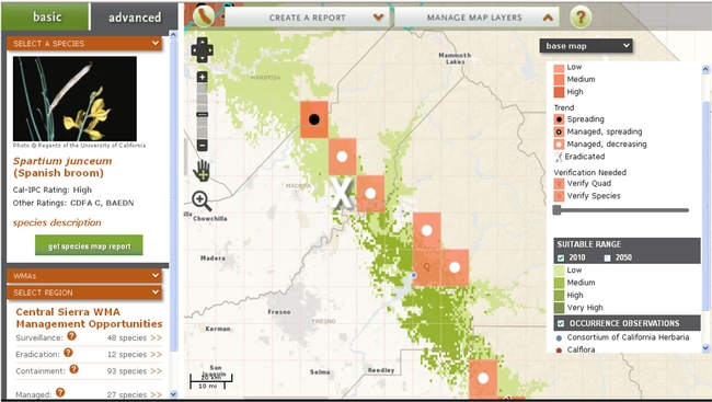
CalWeedMapper is a new website for mapping invasive plant spread and planning regional management strategies (calweedmapper.calflora.org). Users generate a report for their region that synthesizes information into three types of strategic opportunities: surveillance, eradication and containment. Land managers can use these reports to prioritize their invasive plant management, to coordinate at the landscape level (county or larger) and to justify funding requests. For some species, CalWeedMapper also provides maps of suitable range that show where a plant might be able to grow in the future. The system was developed by the California Invasive Plant Council (Cal-IPC, www.cal-ipc.org) and is designed to stay current by allowing users to edit data.

Users can generate reports in pdf format based on a selected region or species. The Regional Management Opportunity Report provides a summary table of information for all plants that present opportunities for management in the selected region. The Regional Species Report provides a map that illustrates the plant’s spatial distribution in the region. These reports are designed to help land managers prioritize and fund their work. Cal-IPC is working with several regions to develop strategic management plans using the information from CalWeedMapper. Contact us at mapping@cal-ipc.org for more information.
This dynamic tool allows users to comment on and update abundance, spread and management information. Also, any new occurrence data submitted to either Calflora or CCH will update the data in CalWeedMapper. As a result, the maps will show current information.
To show where a given plant is most likely to spread, CalWeedMapper also displays suitable range based on climate. Computer models were used to generate suitable range for some plant species based on where they currently grow. The maps show the areas that contain suitable range based on climate conditions in 2010 and 2050. These maps can help land managers with climate adaptation planning and preparing for the movement of new invasive plants into their region.